Vietnam is about 1,650 km from top to bottom, and its weather does not behave like one country’s. Hanoi can be 12C and drizzly while Ho Chi Minh City is 32C and bone dry, and the month that floods Hoi An is often one of the best for the northern rice terraces. This guide covers the climate region by region, with monthly temperature, rainfall and sea temperature tables, then explains the two monsoons and the typhoon season.
If you want a verdict on which months to book, our best time to visit Vietnam guide is built for that. This page is the reference behind it: the numbers and the mechanics.
All figures below are long-term monthly averages, rounded, and rainfall varies a lot year to year. They are a guide to likelihood, not a forecast. Check the national forecast from Vietnam’s National Center for Hydro-Meteorological Forecasting close to departure.
How Vietnam’s climate works
Two seasonal winds drive almost everything.
- Southwest monsoon (roughly May to October): warm, humid air from the Indian Ocean. It brings the wet season to the south, the Mekong Delta and the north. The central coast is shielded by the Truong Son (Annamite) mountains, which is why it stays hot and comparatively dry in summer.
- Northeast monsoon (roughly October to March): cooler air from China. It brings cold, grey, drizzly weather to the north, and because it crosses the South China Sea before hitting the central coast it dumps heavy rain there from September to December. The south sits in its dry season.
Add latitude and altitude. Da Lat (about 1,500 m) and Sapa (about 1,500 m) run 8 to 10C cooler than the lowlands at the same latitude. The north has real winters; the south does not.
North Vietnam: Hanoi, Ha Long Bay, Ninh Binh, Sapa
Four distinct seasons. Winter (December to February) is cool and grey with fine drizzle, spring (March to April) is humid and warming, summer (May to September) is hot, wet and the typhoon window, and autumn (October to November) is the clearest and most comfortable stretch.
| Month | Hanoi high/low (C) | Rainfall (mm) | Ha Long Bay sea temp (C) |
|---|---|---|---|
| January | 20 / 14 | 20 | 18 |
| February | 21 / 15 | 25 | 17 |
| March | 24 / 18 | 45 | 19 |
| April | 29 / 22 | 90 | 23 |
| May | 33 / 25 | 190 | 27 |
| June | 34 / 26 | 240 | 29 |
| July | 34 / 27 | 320 | 30 |
| August | 33 / 26 | 340 | 30 |
| September | 32 / 25 | 250 | 29 |
| October | 29 / 22 | 100 | 27 |
| November | 25 / 18 | 45 | 24 |
| December | 21 / 15 | 20 | 20 |
What it means on the ground: the Hanoi summer heat index regularly feels like 38 to 40C, so plan Old Quarter walks for early morning. In winter bring a proper jacket. In the mountains it is colder again: Sapa averages roughly 5 to 8C at night in January and frost or even a rare light snowfall is possible. For terrace colour, golden rice is typically September to early October, and flooded, mirror-like terraces come in late May to June.
Ha Long Bay: cruises run year-round, but we find October to April gives the clearest skies. January and February mist can hide the karsts for days, and boats stop sailing when a storm warning is issued. See our Ha Long Bay guide for cruise planning, and browse Hanoi tours once you know your dates.
Central Vietnam: Hue, Da Nang, Hoi An, Phong Nha
The most unusual climate in the country, and the one visitors most often get wrong. It is flipped relative to the north and south: dry and hot from February to August, wet and flood-prone from September to December.
| Month | Da Nang high/low (C) | Rainfall (mm) | Sea temp (C) |
|---|---|---|---|
| January | 24 / 19 | 90 | 22 |
| February | 26 / 20 | 30 | 22 |
| March | 28 / 21 | 40 | 24 |
| April | 31 / 23 | 60 | 26 |
| May | 33 / 25 | 100 | 28 |
| June | 34 / 26 | 90 | 29 |
| July | 34 / 26 | 70 | 29 |
| August | 34 / 26 | 120 | 29 |
| September | 31 / 24 | 350 | 28 |
| October | 28 / 23 | 550 | 27 |
| November | 26 / 21 | 450 | 25 |
| December | 24 / 19 | 200 | 23 |
What it means on the ground: from March to August the beaches near Da Nang and Hoi An are at their best, with calm seas and sea temperatures of 26 to 29C. Inland, Hue and the Phong Nha caves can feel brutal in June and July, when hot, dry air spilling over the mountains pushes temperatures to 37 to 40C. October is the wettest month by a wide margin, averaging more than 500 mm and often delivering the heaviest single downpours.
Flooding: the Thu Bon river regularly floods Hoi An Ancient Town in October and November, usually for a day or two, and Hue floods when the Perfume River rises. This is not a freak event, it is part of the annual cycle. Read the latest central Vietnam flood alert to see how it looked in October 2026. January to February is the shoulder: cool (often 18 to 22C at night), showery and overcast, but rarely severe.
South Vietnam: Ho Chi Minh City, Mekong Delta, Phu Quoc, Con Dao
Only two seasons, and they are easy to read. Hot and dry from December to April, hot and wet from May to October, with temperatures barely moving all year.
| Month | HCMC high/low (C) | Rainfall (mm) | Phu Quoc sea temp (C) |
|---|---|---|---|
| January | 32 / 22 | 14 | 27 |
| February | 33 / 23 | 4 | 27 |
| March | 34 / 25 | 12 | 28 |
| April | 35 / 26 | 45 | 29 |
| May | 34 / 26 | 220 | 29 |
| June | 32 / 25 | 330 | 29 |
| July | 32 / 25 | 320 | 28 |
| August | 32 / 25 | 270 | 28 |
| September | 31 / 25 | 340 | 28 |
| October | 31 / 24 | 270 | 28 |
| November | 31 / 23 | 115 | 28 |
| December | 31 / 22 | 50 | 27 |
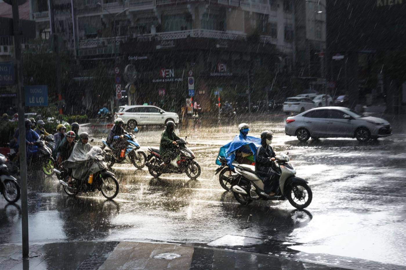
What it means on the ground: April is the hottest, most humid month and the one that tests visitors most, with real-feel temperatures above 40C in the afternoon. During the wet season, rain tends to arrive as a heavy 1 to 2 hour downpour in the mid-afternoon, so mornings are usually fine, and Ho Chi Minh City streets can flood briefly during high tides combined with heavy rain. The Mekong Delta is greenest and at its fullest from September to November, when the floating markets are busy.
Islands: Phu Quoc is best from November to April, when seas are calm and clear. From June to September the west coast gets rougher seas and reduced underwater visibility, and some boat trips are cancelled. Con Dao works the other way for some activities, since turtle nesting runs roughly May to September. Nha Trang and Mui Ne, on the south-central coast, have a drier pattern than the rest of the central region (Mui Ne is one of the driest places in Vietnam), with the best beach weather from February to September.
The highlands: Da Lat and the northern mountains
Altitude overrides latitude. Da Lat sits near 1,500 m and averages roughly 17 to 25C year-round, with a dry season from December to March and rain from May to October. Pack a layer for evenings. In the far north (Sapa, Ha Giang, Mu Cang Chai) winter nights can fall below 5C, and cloud often sits in the valleys until late morning. If your trip crosses regions, our what to pack for Vietnam list covers the layers and rain gear you need.
Typhoon season in Vietnam
Typhoon season officially runs from about June to November, with the peak shifting south over the months:
- July to September: the north (Quang Ninh, Hai Phong, Ha Long Bay, Hanoi) is most exposed. Typhoon Yagi in September 2024 was the strongest to hit the north in decades and caused serious flooding in the Red River basin, including Hanoi.
- September to November: the central coast (Thanh Hoa down to Quang Ngai, including Hue, Da Nang and Hoi An) takes the bulk of landfalls. Storms from this period often combine with northeast monsoon rain to cause flooding.
- October to December: storms occasionally reach the south-central coast (Nha Trang, Quy Nhon) and, more rarely, the south.
Vietnam typically sees around 4 to 6 storms or tropical depressions make landfall each year, and some years bring more. A typhoon rarely ruins a whole trip, but it can close airports, cancel Ha Long Bay cruises and trains, and flood roads for several days.
If a storm is forecast:
- Check the official bulletin from the National Center for Hydro-Meteorological Forecasting and your embassy’s travel advice.
- Confirm cruise, flight and train status directly with the operator. Airlines usually offer free changes when an airport is affected.
- Stay put once local authorities issue a warning. Do not go to the coast, beaches or boats.
- Keep a buffer day before an international flight when travelling in the central coast between September and November.
Travel insurance with weather and cancellation cover matters most in this window; see our Vietnam travel insurance guide. A local eSIM also helps you follow warnings, which we cover in the Vietnam eSIM guide.
Recent storm and flood coverage
We track weather events as they happen. These are the pieces that show what typhoon season looks like in practice:
- Typhoon Wipha travel warning for northern Vietnam (July 2026)
- Typhoon Noul and southeast Asia flight disruptions (July 2026)
- Central coast typhoon season warning (September 2026)
- Northern Vietnam floods (September 2026)
- Central Vietnam floods (October 2026)
Monthly guides
Once you know the regional pattern, these month pages cover events, crowds and what to do:
- Vietnam in January
- Vietnam in February
- Vietnam in March
- Vietnam in April
- Vietnam in May
- Vietnam in June
- Vietnam in July
- Vietnam in August
- Vietnam in September
- Vietnam in October
- Vietnam in November
- Vietnam in December
Quick regional comparison
| Season | North | Central | South |
|---|---|---|---|
| Dec to Feb | Cold, grey, drizzle | Mild, showery (Dec wet) | Hot, dry, best |
| Mar to Apr | Warm, humid, pleasant | Hot, dry, best | Hottest, driest end |
| May to Aug | Hot, very wet, storms | Hot, dry (37C+ inland) | Hot, afternoon rain |
| Sep to Nov | Clear, comfortable (Sep storms) | Wettest, floods, typhoons | Wet, easing in November |
Planning a route across regions is the real skill. A north-to-south trip in March to April, or a south-to-north trip in the opposite direction, keeps you in dry weather longest. Our Vietnam by train guide is useful for that kind of route, and our north vs south Vietnam comparison helps if you only have time for one half.