Mu Cang Chai Rice Terraces 2026: Seasons, Viewpoints and Photography
Book an experience
Top-rated experiences in Mu Cang Chai
The highest-rated tours and activities in Mu Cang Chai. Book today, cancel free if plans change.
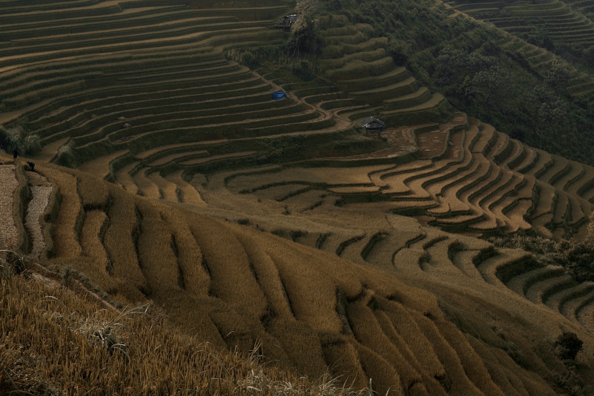
The rice terraces of Mu Cang Chai are carved into mountain slopes at 800–1,200m elevation across 2,200 hectares. Listed as a National Scenic Heritage site, the system is among the most extensive and visually dramatic terrace landscapes in Southeast Asia.
How the terraces were built
The terraces were hand-built by Black Hmong communities over centuries. The construction method is entirely manual — earth is shaped into level platforms following contour lines down the hillside, each terrace retained by a small earthen berm. Water is directed through the system by channels cut along the hillside above. The precision required to level each terrace to hold water is considerable.
A mature terrace system like Mu Cang Chai represents hundreds of years of cumulative work. The youngest terraces visible today are still decades old.
Seasonal appearance
The terraces change appearance dramatically through the agricultural year:
| Period | Appearance | Notes |
|---|---|---|
| Late May–June | Flooded mirror terraces | Water reflects sky and mountains — equal to harvest visually |
| July–August | Deep green rice growing | Lush but less dramatic |
| Late September | Gold harvest season | Peak season, peak crowds |
| October–November | Stubble after harvest | Fields being prepared for next planting |
| December–March | Bare or planted | Quietest period |
The exact dates for flooding and harvest shift 1–2 weeks by year. Local farmers and guesthouses know current conditions.
The three main commune areas
La Pan Tan (9km from town): The most visited area. A ridge road runs through dense terracing — the terraces drop on both sides. The main viewpoint is a pull-off where the terraces are directly below the road. The density of terracing here is higher than anywhere else in the district.
De Xu Phinh (17km from town): Larger scale. The terraces cover an entire valley system — less concentrated than La Pan Tan but more overwhelming in total area. The road through De Xu Phinh passes several good viewpoint positions without an obvious single “best” spot.
Che Cu Nha (10km from town): The most accessible of the three main communes. The terraces are good but slightly less dramatic than La Pan Tan or De Xu Phinh. Worth a stop but not the primary destination.
Photography
The terrace landscape is genuinely photographic — it has been featured in major travel photography publications and the annual harvest photos circulate widely online.
Best light: Sunrise over La Pan Tan (06:00–08:00) or sunset over De Xu Phinh (17:00–18:30). The terrace colours are most saturated in the hour after sunrise and before sunset.
Overcast vs sunny: The flooded water-season terraces photograph better in overcast light (softer reflections). The harvest gold terraces photograph well in direct sun.
Drone: Many photographers fly drones over the terraces. Check current regulations — drone use near settlements requires notification and there are restrictions in protected areas.
Cultural context
The terraces are working farmland, not tourist infrastructure. The fields are owned and farmed by Black Hmong families. Walking across the terrace berms compacts the earth and can damage the retaining walls — stay on designated paths or the road edges. During planting and harvest, farmers are working in the fields — keep interaction respectful and non-intrusive.
More in Mu Cang Chai
- Best Hostels in Mu Cang Chai 2026: Guesthouses and Terrace Homestays
- Best Time to Visit Mu Cang Chai 2026: Harvest Season and Water Season
- Getting to Mu Cang Chai 2026: Bus from Hanoi and the Northwest Loop
- Things to Do in Mu Cang Chai 2026: Terraces, Villages and Trekking
- Where to Stay in Mu Cang Chai 2026: Guesthouses and Homestays
Frequently Asked Questions
- Which is the best rice terrace viewpoint at Mu Cang Chai?
- La Pan Tan (9km from town) is the most visited — a ridge road with terraces dropping steeply on both sides. De Xu Phinh (17km) has larger-scale terracing covering an entire valley system. Both are exceptional.
- How were the Mu Cang Chai terraces built?
- Entirely by hand by Black Hmong communities over centuries. Earth was shaped into level platforms following contour lines, each retained by a small earthen berm. Water is directed through channels cut along the hillside. A mature terrace system represents hundreds of years of cumulative work.
- Can I fly a drone over Mu Cang Chai rice terraces?
- Many photographers fly drones, but check current regulations — drone use near settlements requires notification and there are restrictions in protected areas.
- When should I photograph Mu Cang Chai terraces?
- Best light is sunrise over La Pan Tan (06:00-08:00) or sunset over De Xu Phinh (17:00-18:30). Flooded water-season terraces photograph better in overcast light (softer reflections). Harvest gold terraces photograph well in direct sun.
Ready to explore?
Browse hundreds of tours and activities. Book securely with free cancellation on most options.
Browse on GetYourGuide →We may earn a small commission — at no extra cost to you.