Ha Giang Travel Guide 2026: The Loop, Karst Plateau and Remote Vietnam
Ha Giang travel guide — the Ha Giang Loop motorbike route, Dong Van Karst Plateau UNESCO Geopark, ethnic minority communities and the best time to visit.
Guides for Ha Giang
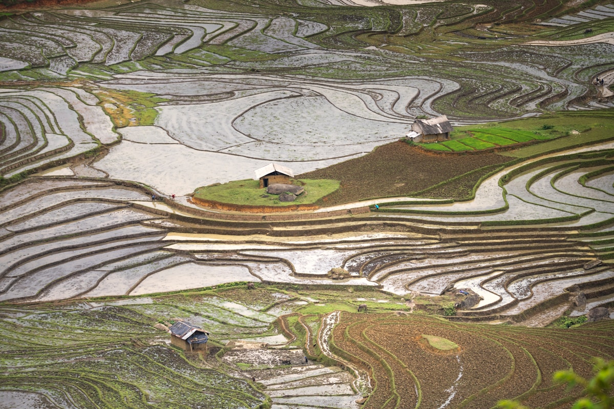
Ha Giang is Vietnam’s northernmost province and the country’s most dramatic landscape by some measure. The Dong Van Karst Plateau — a UNESCO Global Geopark covering 2,350km² of near-vertical limestone karst, deep river canyons, and remote ethnic minority villages — runs along the Chinese border at the top of the country.
The Ha Giang Loop is the 350km motorbike circuit through this landscape that has become one of Southeast Asia’s most celebrated rides. It is not a tourist attraction with a gift shop and a viewing platform. It is a genuine journey through one of the most extraordinary places in mainland Asia.
Quick facts
- Distance from Hanoi: 310km, 5–6 hours by bus
- Best time to visit: October (buckwheat flower bloom — tam giác mạch, pink-white flowers covering the plateau) and September (rice harvest gold in Hoang Su Phi). Also good: March–May (green, clear weather). Avoid December–January (very cold, foggy, often miserable for motorbike riding).
- Permit requirement: Foreign nationals are required to register at the Ha Giang checkpoint before starting the loop. Your accommodation in Ha Giang town can assist with this — it costs a small administrative fee and takes 30 minutes. Don’t skip it.
- Currency: Vietnamese Dong (₫). Cash only outside Ha Giang town. Bring sufficient cash before departing on the loop — ATMs don’t exist in loop towns.
The landscape
The Dong Van Karst Plateau is geologically ancient — the limestone formations are 400–600 million years old and represent some of the oldest exposed rock surface in Southeast Asia. The plateau sits at an average altitude of 1,000–1,600m, with peaks reaching 2,000m+. The Tu San Canyon (the Nho Que River gorge visible from Ma Pi Leng Pass) is reportedly one of the deepest gorges in Southeast Asia at approximately 700m.
The combination of extreme altitude, thin soil, and cold winters produces a landscape unlike anywhere else in Vietnam. The ethnic communities who live here — Hmong, Tay, Lo Lo, Pu Peo, Giay — have adapted their agriculture and architecture to conditions more similar to southwest China than to lowland Vietnam.
The ethnic communities
Ha Giang has 19 ethnic minority groups. The Hmong are the largest (many villages, particularly on the high plateau). The Lo Lo community is concentrated around Dong Van town — their textile traditions and architecture (two-story adobe houses with blue-painted woodwork) are distinct from the Hmong. The Pu Peo are among the smallest ethnic groups in Vietnam with fewer than 1,000 people remaining.
The Sunday markets at Dong Van, Meo Vac, and smaller villages rotate on weekly schedules and are the best places to see ethnic minority communities in their own context. The Meo Vac Sunday market is the largest and most atmospheric.
Costs
Ha Giang is cheap by Vietnamese standards outside Ha Giang town’s small tourist economy.
- Budget guesthouse in Ha Giang town: ₫200,000–400,000 ($8–16)
- Guesthouse along the loop route: ₫100,000–250,000 ($4–10)
- Motorbike rental (semi-auto): ₫150,000–250,000/day ($6–10)
- Easy Rider guide (motorbike with driver): ₫500,000–800,000/day ($20–32) including guide
- Meals along the loop: ₫30,000–80,000 ($1.20–3.20) per meal
The loop circuit of 3–4 days costs approximately ₫1,000,000–2,500,000 ($40–100) total excluding accommodation, depending on motorbike type and whether you hire a guide driver.
Frequently Asked Questions
How far is Ha Giang from Hanoi? Ha Giang is 310km from Hanoi, taking 5–6 hours by bus from My Dinh bus station. There are no flights or trains to Ha Giang town. Book a sleeper bus for the overnight option.
Do I need a permit to ride the Ha Giang Loop? Foreign nationals must register at the Ha Giang Public Security checkpoint before starting the loop. Your accommodation in Ha Giang town can assist with this — it costs a small administrative fee and takes about 30 minutes. Do not skip it.
How much does the Ha Giang Loop cost? The 3–4 day loop circuit costs approximately ₫1,000,000–2,500,000 ($40–100) total excluding accommodation. Motorbike rental runs ₫150,000–250,000/day ($6–10). An Easy Rider guide costs ₫500,000–800,000/day ($20–32). Guesthouses along the route cost ₫100,000–250,000 per night.
What ethnic groups live in Ha Giang? Ha Giang has 19 ethnic minority groups. The Hmong are the largest. The Lo Lo community near Dong Van is known for their distinctive adobe houses with blue-painted woodwork. The Pu Peo are among Vietnam’s smallest ethnic groups with fewer than 1,000 people remaining.
Are there ATMs along the Ha Giang Loop? No. ATMs do not exist in the loop towns — bring sufficient Vietnamese Dong before leaving Ha Giang town. Cash only is standard outside Ha Giang town itself.
More in Ha Giang
- Things to Do in Ha Giang
- The Ha Giang Loop — Complete Guide
- Ha Giang Loop Route Planning
- Motorbike Rental in Ha Giang
- Trekking in Ha Giang
- Best Restaurants in Ha Giang
- Where to Stay in Ha Giang
- Best Hostels in Ha Giang
- Best Time to Visit Ha Giang
Nearby destinations
Plan your trip
Book an experience
Top experiences in Ha Giang
Explore the best tours and activities in Ha Giang — instant confirmation, free cancellation on most bookings.