Ha Giang Loop Route Planning 2026: Day-by-Day Itinerary
Book an experience
Top-rated experiences in Ha Giang Guide
The highest-rated tours and activities in Ha Giang Guide. Book today, cancel free if plans change.
Contents
- Before you start: Permit registration
- Day 1: Ha Giang town to Quan Ba (46km, 2–3 hours riding)
- Day 2: Quan Ba to Dong Van (94km, 4–5 hours riding including stops)
- Day 3: Dong Van to Meo Vac via Ma Pi Leng Pass (23km, 1.5–2 hours riding but plan 4–5 hours for stops)
- Day 4–5: Return to Ha Giang
- Fuel and logistics notes
- More in Ha Giang
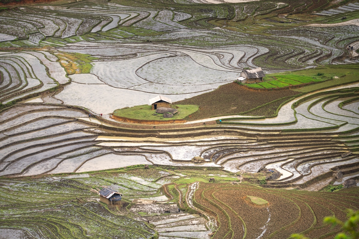
The standard Ha Giang Loop covers approximately 350km over 4–5 days. Here is a day-by-day breakdown of the most common route.
Before you start: Permit registration
Foreign nationals must register at the Ha Giang Public Security checkpoint at the northern edge of Ha Giang town before proceeding on the loop. Your guesthouse will assist with the paperwork (bring your passport). Cost: small administrative fee (around ₫20,000–50,000, cash). The process takes 30 minutes.
This registration is not negotiable — it’s a standard requirement and the checkpoint will turn you back if you don’t have the paperwork. Most guesthouses handle it as part of the standard check-in process.
Day 1: Ha Giang town to Quan Ba (46km, 2–3 hours riding)
Key stops:
- Heaven’s Gate (Cổng Trời): 45km from Ha Giang on the road to Quan Ba, a narrow pass where the road threads between two peaks. The view north into the karst plateau opens up here for the first time. On clear days, extraordinary. The road up to Heaven’s Gate is the first serious test of the climb — 12km of ascending switchbacks.
- Twin Mountains (Núi Đôi — Fairy Bosom Mountain): Visible from the Heaven’s Gate viewpoint. Two perfectly symmetrical limestone cones rising from the Quan Ba valley. One of the most distinctive landmarks on the loop.
- Quan Ba town: The first loop town, quiet, with guesthouses. Small Sunday market.
Road: Good surface. The climb to Heaven’s Gate is the most demanding section. First-day legs are often tighter than expected on mountain gradients.
Overnight: Quan Ba town. Guesthouses ₫100,000–250,000 ($4–10) per night.
Day 2: Quan Ba to Dong Van (94km, 4–5 hours riding including stops)
Key stops:
- Yen Minh: A mid-route town with good food options and fuel. Pine forests on the approach give the area a different feel from the exposed karst.
- Lung Cu Flagpole (detour, 24km from Dong Van): Vietnam’s northernmost point on the Chinese border. A large flagpole on a hilltop with 360° views across the border. The 300-step climb is worth it. The Lo Lo ethnic minority village at the base has traditional two-story adobe houses. Note: This detour adds significant time and is optional but well worth doing if you have the day.
- Dong Van Ancient Town: The most interesting town on the loop. A cluster of traditional stone houses built in a Sino-Vietnamese architectural style (French colonial influence + local vernacular). The central market area comes alive on the weekend when Hmong communities come down from surrounding villages. The Black Hmong Sunday market in Dong Van is one of the loop’s highlights.
- Dong Van Karst Plateau viewpoints: The plateau itself becomes fully visible on the approach to Dong Van. The scale of the karst is most apparent from the high road sections between Yen Minh and Dong Van.
Overnight: Dong Van town. Better guesthouse range than Quan Ba. ₫150,000–300,000 ($6–12).
Day 3: Dong Van to Meo Vac via Ma Pi Leng Pass (23km, 1.5–2 hours riding but plan 4–5 hours for stops)
This is the most important day on the loop. The 23km between Dong Van and Meo Vac crosses the Ma Pi Leng Pass — the most dramatic section of road in Vietnam and possibly in Southeast Asia.
Ma Pi Leng Pass: The road cuts across a near-vertical limestone cliff face approximately 1,600m above the Nho Que River gorge below. The engineering is extraordinary. There are several pullout points where you can stop to look down into the Tu San Canyon (the gorge), across to the facing cliff faces, and along the river.
Tu San Canyon: The Nho Que River at the bottom of the canyon is turquoise from the limestone sediment. A viewpoint on the road looks directly down approximately 700m. Boats run along the canyon from Meo Vac — a possible afternoon activity.
Meo Vac: Larger than Dong Van with a better range of guesthouses and restaurants. The Sunday market here is the most atmospheric on the loop — the largest Hmong market in Ha Giang province. Timing the loop to be in Meo Vac on a Sunday morning (5:30–9am) is worth building the itinerary around.
Overnight: Meo Vac. ₫150,000–300,000 ($6–12).
Day 4–5: Return to Ha Giang
Option A (direct, 100km via Bao Lac, 3–4 hours): The south road via Bao Lac and Meo Vac. This route is faster but less scenic than the northern loop. Good road surface.
Option B (scenic return via Du Gia, 150km, 5–6 hours): The longer return via the Du Gia river valley. The landscape changes character from the harsh plateau to forested valley and river scenery. A very different experience from the outward journey.
Most riders choose Option B for the final day — it provides a contrast to the plateau experience and is genuinely beautiful in its own right.
Fuel and logistics notes
- Fuel: Petrol stations exist in Ha Giang town, Quan Ba, Yen Minh, Dong Van, and Meo Vac. Carry extra fuel between Dong Van and Meo Vac as the distance and elevation consume more than expected.
- Food: Simple Vietnamese rice and noodle dishes available at every town. Budget ₫50,000–80,000 ($2–3.20) per meal.
- Cash: No ATMs along the route outside Ha Giang town. Bring all cash before departing.
- Phone signal: Viettel has the best coverage in rural northern Vietnam. Signal exists in all loop towns but can drop in the karst valleys between.
More in Ha Giang
- Best Hostels in Ha Giang 2026: Budget Loop Accommodation
- Food in Ha Giang 2026: What to Eat on the Loop
- Best Time to Visit Ha Giang 2026: Buckwheat Flowers and Harvest Season
- The Ha Giang Loop 2026: Vietnam’s Most Dramatic Motorbike Route
- Ha Giang Motorbike Rental 2026: Semi-Auto, Manual and Easy Rider
- Things to Do in Ha Giang 2026: The Loop, Markets and Karst Plateau
- Trekking in Ha Giang 2026: Hoang Su Phi and Village Treks
- Where to Stay in Ha Giang 2026: Town Guesthouses and Loop Accommodation
Frequently Asked Questions
- What is the day-by-day Ha Giang Loop itinerary?
- Day 1: Ha Giang to Quan Ba (46km) via Heaven's Gate and Twin Mountains. Day 2: Quan Ba to Dong Van (94km) via Yen Minh, with optional Lung Cu detour. Day 3: Dong Van to Meo Vac (23km) via Ma Pi Leng Pass. Day 4-5: Return to Ha Giang via Bao Lac (100km direct) or Du Gia scenic route (150km).
- How do I register for the Ha Giang Loop permit?
- Register at the Ha Giang Public Security checkpoint at the northern edge of town before departing. Bring your passport. Your guesthouse will assist with the paperwork. Cost is a small fee of around 20,000-50,000 VND. The process takes 30 minutes. The checkpoint will turn you back without it.
- What is Heaven's Gate on the Ha Giang Loop?
- Heaven's Gate (Cong Troi) is a narrow pass 45km from Ha Giang where the road threads between two peaks. The view north into the karst plateau opens up for the first time. The road up is a 12km climb of ascending switchbacks — the first serious test on the loop.
- Which return route is better from Meo Vac to Ha Giang?
- Most riders choose Option B via the Du Gia river valley (150km, 5-6 hours) for the scenic contrast from the plateau experience — forested valley and river scenery. Option A via Bao Lac (100km, 3-4 hours) is faster but less scenic.
- Where can I refuel on the Ha Giang Loop?
- Petrol stations exist in Ha Giang town, Quan Ba, Yen Minh, Dong Van, and Meo Vac. Carry extra fuel between Dong Van and Meo Vac as the distance and elevation consume more than expected. There are no ATMs outside Ha Giang town — bring all cash before departing.
Ready to explore?
Browse hundreds of tours and activities. Book securely with free cancellation on most options.
Browse on GetYourGuide →We may earn a small commission — at no extra cost to you.